

How long is the coastline of Australia? One estimate is that it’s about 12,500 km long. However the CIA world factbook puts the figure at more than double this, at over 25,700 km. How can there exist such different estimates for the same length of coastline? Well this is called the coastline paradox. Your estimate of how long the coastline is depends on the length of your measuring stick – the shorter the measuring stick the more detail you can capture and therefore the longer the coastline will be.
Fractals are typically self-similar patterns that show up everywhere around us in nature and biology. The term “fractal” was first used by mathematician Benoit Mandelbrot in 1975 and used it to extend the concept of theoretical fractional dimensions to geometric patterns in nature, including the seabed.

As part of Earth Day 2013, Monday 22nd April 2013, Conservation International’s (CI’s) Chairman and CEO Peter Seligmann took part in a Twitter conservation, where followers had the opportunity to send in their own pressing questions about conservation issues important to them! Representing seabed related issues, I decided to ask two questions about rhodoliths and deep sea habitats.
Rhodolith beds absorb as much carbon per hectare as the rainforest. How does CI’s work on Abrolhos Seascape help protect maerl? #CIEarthDay
— Seabed Habitats (@seabedhabitats) April 22, 2013
As increasing anthropogenic activity occurs offshore, does CI plan to help protect vulnerable habitats such as cold water coral? #CIEarthDay
— Seabed Habitats (@seabedhabitats) April 22, 2013
Peter S.: Yes, we do, through our #seascapes program, which works to protect broad areas of ocean holistically. #CIEarthDay
— Conservation Intl (@ConservationOrg) April 22, 2013
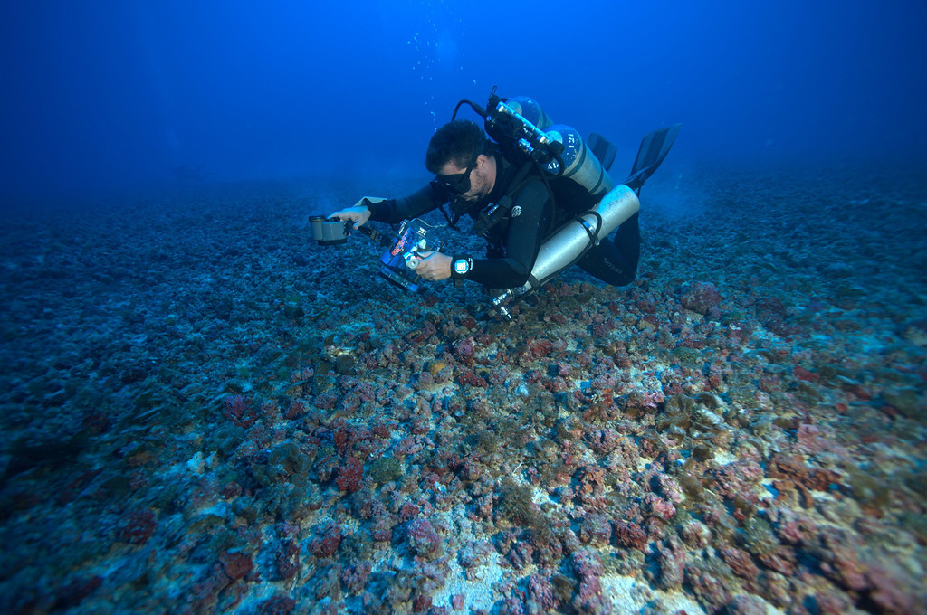
The question on rhodoliths was referring to a recent discovery of the world’s largest rhodolith beds off the coast of Brazil- which cover an estimated 21 000 square km area- an area nearly the size of El Salvador! (Original news article here, with blog post here.)
Another user asked about the which areas CI will be focusing their conservation efforts in future. A particularly interesting answer to the question was:
A question from Moira M., via email: In what areas will CI be focusing its efforts in the immediate future? #CIEarthDay
— Conservation Intl (@ConservationOrg) April 22, 2013
Peter S.: 3 major areas. First: Helping societies understand that people NEED nature — it’s fundamental to prosperity. (1/3) #CIEarthDay
— Conservation Intl (@ConservationOrg) April 22, 2013
Peter S.: Second: helping businesses understand it’s in their enlightened self-interest to protect nature. (2/3) #CIEarthDay
— Conservation Intl (@ConservationOrg) April 22, 2013
Peter S.: Lastly: supporting governments so they can take the necessary steps to protect Earth’s bounty. (3/3) #CIEarthDay
— Conservation Intl (@ConservationOrg) April 22, 2013
Reflecting on Peter’s answer, this coupling between research and education, industry and governments seems to me to be the key to responsible environmental management. Of course this is indeed difficult to do in practice. You can follow more about the organisation’s work on their website, with the full twitter conversation here
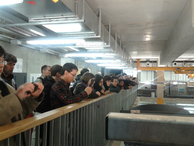
The 12th International Coastal Symposium – ICS 2013, took place at Plymouth University last week. Almost 500 scientists from all around the world came to Plymouth and many presented their research to a truly international audience. The symposium was organised by the Coastal Processes Research Group at Plymouth University. Parallel sessions about Coastal Engineering, Coastal Hazards, Deltas and estuaries, Marine renewable energy, Shoreline change, Coastal ecology and pollution, Sea level and climate change, Coastal management, GIS and remote sensing, Gravel beaches and more took place on campus. Last week my supervisor and I went to Plymouth to attend the conference. I made a presentation about maerl sediment dynamics in the Hydro/Sediment Dynamics session. I had been anticipating the presentation for a while and fortunately it was well received, with interesting and useful scientific feedback. We also made a tour of the hydraulics laboratory within new Marine Science building and took part in a one day field-trip.


The COAST Lab in the new Marine Science building contains flumes, wave tanks and basins for hydrulics work- facilities which are largely unmatched anywhere in the UK. It combines wave, current and wind power to create a dynamic ‘theatre’ appropriate for device and array testing, environmental modelling and coastal engineering. The equipment is flexible that it can generate short and long-crested waves in combination with currents at any direction to the waves, sediment dynamics, tidal effects and wind (COAST Website). Here are some examples of the different types of waves that can be generated by the large wave tank:


For the field trip, I chose to go to the Eden Project in Cornwall and made a visit to the landmark botanical gardens on the Thursday. The Eden Project was built in a 160-year-old exhausted china clay quarry near St Austell. It was established as one of the Landmark Millennium Projects to mark the year 2000. Eden’s mission is “To promote the understanding and responsible management of the vital relationship between plants, people and resources leading to a sustainable future for all.” I enjoyed exploring the warm and humid Rainforest Biome and had a lovely lunch in the Mediterranean Biome.

Lastly, guess what? Plymouth University have their very own seismometer – just like the one which was blogged about a few weeks ago and they take part in the Schools Seismology Project. I was really happy to see one there!!
This year at the Beneath the Waves Film Festival, the short film Mikono ya Wavuvi meaning “In Fishermen’s Hands” won the People’s Choice Award. “Coral reefs are one of the most biodiverse ecosystems in the world, and globally, millions of people depend on the resources they provide. In East Africa, along the coast of Kenya, fishing is often the only option for work, and as a result, communities are highly reliant on coral reefs for food and livelihood. This has resulted in increasingly degraded coral reefs, where very few fish remain and sea urchins take over. Consequently, some fishermen have identified a need for change. This has resulted in an exciting movement for the establishment of community-managed areas closed to fishing, locally called a “tengefu”, which is a Swahili term meaning “to set something aside“. This is a short film about marine conservation in Kenya and the struggle between fishermen saving the ocean or saving their livelihood.”
via Mikono ya Wavuvi (In Fishermen’s Hands) on Vimeo.
“The Beneath the Waves Film Festival aims to encourage, inspire, and educate scientists, advocates, and the general public to produce and promote open-access, engaging marine-issue documentaries. The goal is to facilitate widespread science communication by bringing together marine films from around the world for open discussion, while also providing hands-on educational opportunities for researchers interested in film and media outreach.”
via Beneath The Waves Film Festival.
Further Links
Mikono ya Wavuvi Facebook page
Beneath the Waves Facebook page
This year, at the Irish Geological Research Meeting (IGRM) in Derry, I saw a presentation which quite amazed me. It was about the Seismology in Schools project, made by Emily Neenan of the Dublin Institute for Advanced Studies (DIAS). This is an international programme, which in Ireland is run by DIAS. Following this presentation, I found out more about the scheme:
What is the Seismology in Schools project?
The Seismology in Schools project is an outreach programme introduced by the Dublin Institute for Advanced Studies to schools around Ireland. School children have the opportunity to make real measurements of earthquakes happening around the world from their own classroom. Students monitor the performance of the seismometer daily and consolidate the learning and data collection techniques outlined in the training days. Students upload the recorded earthquake data to the “IRIS Seismographs in Schools” website to share with other schools in Ireland, UK and USA.
The experience of the project has been that learners become more engaged when they see how earthquakes happen in reality and also learn about them through the media. They gain an understanding of earthquake hazards around the world and reflect upon what can be done by scientists and engineers to mitigate the devastating effects of big earthquakes.
What is a seismometer and how does it measure earthquakes?
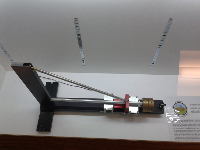
A seismometer is a very sensitive instrument that can detect movements of the Earth’s surface. The type of seismometer used in the scheme is an SEP seismometer, available from Mindset instruments (for UK and Ireland). The SEP Seismometer System uses the same basic principle underlying all seismometers, which is that of inertia. Seismic waves from an earthquake make the ground move relative to the recording device. In the case of the SEP seismometer, there is a large mass on the end of a boom: this stays where it is as the ground moves beneath the seismometer, and this relative movement is recorded.

Please would you give us a quick example of a recently recorded earthquake.
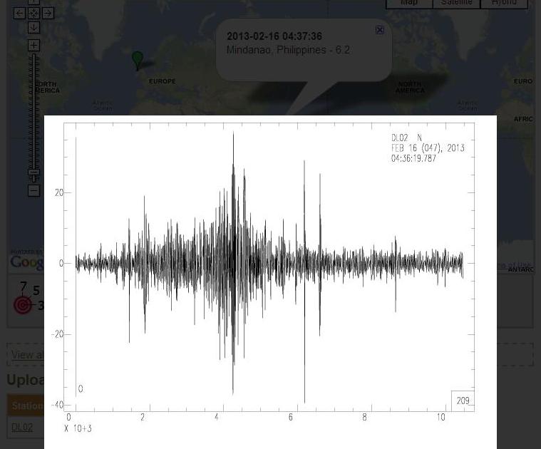
For example, there was a recent earthquake of 6.2 on the Richter scale at Mindanao, Philippines in February, which was recorded by a school in Ireland, using their seismometer. The school processed these data and subsequently uploaded to the IRIS website:
How many schools are involved in the scheme?
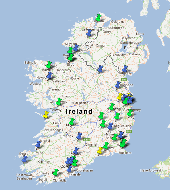
Currently there are 55 Irish primary and secondary schools in the programme and this has now been extended to include colleges, universities and geo-parks. Internationally, there are over 448 schools participating in this scheme, in UK, USA and Ireland. If you know a school which would like to get involved or are a teacher or educator please see the useful links below and get in touch with IRIS (USA), DIAS (Ireland) or the BGS (UK) via their “Contact forms”.
Useful Links
Dublin Institute for Advanced Studies Seismology In Schools website (Ireland) with IRIS Contact form or by emailing Emily Neenan (eneenan*atsign*cp.dias.ie)
IRIS Seismographs In Schools website (USA) with IRIS Contact form
British Geological Survey School Seismology project website (UK) with BGS Contact form
Mindset seismometers website
Acknowledgements
Thank you to Emily Neenan of the Dublin Institute of Advanced Studies, Ireland, for information used as part of this blog post. It has helped us learn about a unique outreach programme, which can potentially inspire the younger generation to study the geosciences plus make us all more earthquake aware!! Happy St Patrick’s Day.
A hydrothermal vent is a fissure in a planet’s surface from which geothermally heated water issues. Hydrothermal vents are commonly found near volcanically active places, areas where tectonic plates are moving apart, ocean basins, and hotspots. Hydrothermal vents exist because the earth is both geologically active and has large amounts of water on its surface and within its crust. Common land types include hot springs, fumaroles and geysers. Under the sea, hydrothermal vents may form features called black smokers. Relative to the majority of the deep sea, the areas around submarine hydrothermal vents are biologically more productive, often hosting complex communities fueled by the chemicals dissolved in the vent fluids. Chemosynthetic archaea form the base of the food chain, supporting diverse organisms, including giant tube worms, clams, limpets and shrimp.
The Endeavour Mid-ocean Ridge is an exciting study location because it is a place where new volcanic seafloor is constantly created at the spreading boundary between the Juan de Fuca and Pacific plates. The region (approximately 300 km off the British Columbia coast), has been the site of intensive investigation for more than 20 years.The Ocean Networks Canada Observatory, comprising VENUS and NEPTUNE Canada cabled networks, supports transformative coastal to deep ocean research and technology. It enables real-time interactive experiments, focused on ocean health, ecosystems, resources, natural hazards, and marine conservation. The Observatory is a national facility led by the University of Victoria for a pan-Canadian consortium of universities and partners.
NEPTUNE Canada’s real-time monitoring capability will benefit both ongoing and new experiments. Continuous data gathered before, during and after events like earthquakes and intrusions will be recorded across a coordinated suite of instruments both at the hydrothermal vents on the seafloor and within moorings extending 250m up into the 2,200m water column. A network of seismometers here and at other sites will provide high resolution information on tectonic processes such as earthquakes and strain across the Juan de Fuca plate.
via NEPTUNE Canada: Endeavour and Wikipedia.
Some more footage of the Endeavour ridge hot vents acquired using the ROPOS ROV. See also the BBC news report about a recent British expedition to the Cayman Trough to the deepest undersea vents.